Resources

Case studies and webinars


Illustration of a cloud-based geospatial platform connecting maps, data and devices
Case studies

Customer stories

Read the LTSA case study (PDF)
Land titles

Survey plan submission and parcel integration for LTSA

We partnered with LTSA (Land Title and Survey Authority of British Columbia) to deliver the Survey Plan Submissions service, a modern, map-based digital workflow that speeds surveyor submissions, keeps the parcel fabric current and reduces manual re-entry across government registries.

Read the case study

Read the Jamaica PDMS modernization case study (PDF)
Parcel Fabric

Parcel Data Management System (PDMS) modernization for Jamaica

Jamaica's National Land Agency (NLA) manages the country's primary land information. We advised and supported their team through the move from ArcGIS Desktop data to Esri's ArcGIS Pro Parcel Fabric.

Read the case study

Read the GIS modernization case study (PDF)
GIS modernization

GIS modernization for a land management platform

When Esri ended support for ArcGIS Desktop, this company needed to modernize its land management platform and cut costs by moving from custom software to off-the-shelf components. We migrated its data to ArcGIS Pro and updated the software.
Read the case study

Read the Town of Stony Plain FME case study (PDF)
FME automation

FME services for the Town of Stony Plain

The Town of Stony Plain had very basic GIS. Data was undependable, and upkeep was a laborious process that consumed most of the GIS team's time. We set up FME workspaces and a series of automations to free up considerable time for the GIS team.
Read the case study

Read the SPOC modernization case study (PDF)
Survey plans

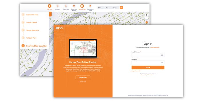
Modernizing the Survey Plan Online Checker (SPOC) for Alberta

With SPOC's browser technology losing support, the Alberta Land Titles Office and more than 400 Alberta land surveyors were at risk. We rebuilt SPOC using Safe Software's FME and Amazon Web Services (AWS).
Read the case study

Read the Saskatchewan PSO case study (PDF)
Plan submissions

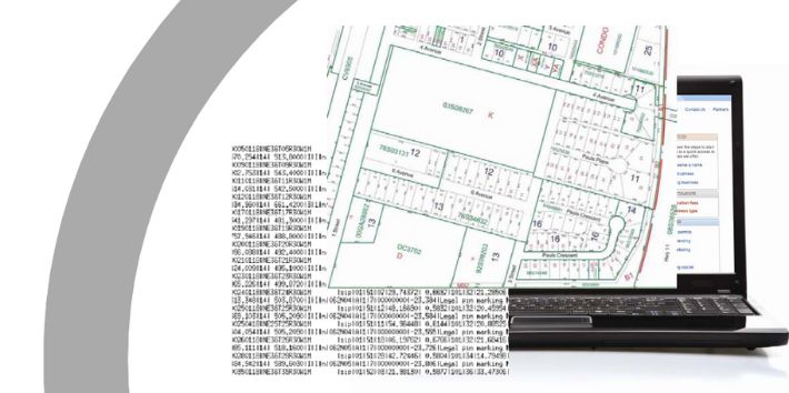
Plan Submissions Online (PSO) for Saskatchewan

To remove paperwork and improve service, we built a web-based plan submission and checking tool for ISC (Information Services Corporation) that automatically checks business rules before plans go to Plan Processing.
Read the case study

Read the High River flood relief case study (PDF)
Emergency response

High River flood relief

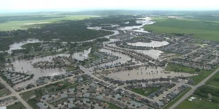
When floods hit High River, Alberta in June 2013, the MNC and Silvacom CS team provided immediate GIS support and data management, and built an application to help complete property assessments and organize remediation.

Read the case study

Webinars

Watch our webinars

As experts in web application modernization, we have developed a webinar series to help decision-makers understand what needs to be considered at each step in the process.

Testimonials

What our customers say

Silvacom CS brought exceptional technical insight

At the LTSA, we rely on Silvacom as a trusted strategic partner for our GeoSpatial solutions. Most recently, we partnered on an innovative R&D initiative to automate the integration of Posting Plans into our Parcel Fabric. Silvacom brought exceptional technical insight and a strong grasp of our business needs, paired with deep expertise in ESRI products, FME, and Parcel Fabrics. Their leadership and collaboration delivered a seamless and successful Proof of Concept. The outcome was clear roadmap to impactful automation that will drive significant time savings and operational efficiencies in a mission-critical workflow.

Taylor McInnes Manager, GeoData Services, Landsure

Silvacom CS saved my sanity

We are a small municipality who were trying to get the basics of our new GIS system functioning and automated. The Silvacom CS team took the time to figure out where we were at in our journey and provide solutions that just worked. They have been available to answer questions and help with things since finishing the work. They were flexible and worked with us to fit our budget and timeline. I would not have been able to get our GIS system to the level it is now without them.

GIS Coordinator, Town of Stony Plain

Silvacom CS brings great leadership and experience

We were fortunate to have Silvacom CS as our partner for over a decade on a very complex engagement. Throughout the journey, Silvacom CS’ leadership around geospatial data and experience with visioning and creating a visually appealing user experience were key pieces to our joint success. Their responsiveness, flexibility and commitment to a successful outcome make Silvacom CS a great partner.

Craig Coward Client Executive, NTT Data Services

Choosing Silvacom CS proved to be the right decision for us

Silvacom’s process of design and implementation kept multiple stakeholders from several different organizations/jurisdictions well informed through the design and development of a much-needed critical infrastructure digital project that impacts us all as Albertans.

Todd Nash Partner, Consulting Services, MNP

I highly recommend the Silvacom team

They worked very hard to understand our vision and turn it into something that is tangible, user-friendly, and visually appealing.

Brock Mulligan Director of Communications, Alberta Forest Products Association

Silvacom has been great to work with

We were looking to develop a technical solution for tracking, displaying and storing its forest history photographs, stories and information. My team is not well versed in technology options; thankfully the Silvacom CS team has made the process easy while engaging our members in the analysis and review. I highly recommend Silvacom CS considering the experience their team brings to a project or initiative.

Bruce Mayer Secretary-Treasurer, Forest History Association of Alberta

Silvacom CS helped us create the website we needed to elevate our program

With a short turnaround time, we were glad to have the Silvacom CS team on our side! Their team worked diligently to not only ensure that our new website was completed within a tight deadline but that we were involved in every step of the design process. With their expertise, we felt comfortable that our vision for a website that would highlight and bolster our program would be executed to the best of their abilities. Silvacom CS is a great partner, and we would recommend their services to other organizations.

Project Coordinator, FAST Program
FAQs

Frequently asked questions about our resources

What will I learn from your case studies?

Each case study walks through a real project: the challenge our customer faced, the solution we built and the results. They cover land titles, Parcel Fabric migration, GIS modernization, FME automation, survey plan checking and emergency response. Every case study is a free PDF you can open straight away, no form required.

Do you have examples of ArcGIS Pro Parcel Fabric migrations?

Yes. Our Jamaica PDMS (Parcel Data Management System) and GIS modernization case studies both cover moving from ArcGIS Desktop to ArcGIS Pro and the Parcel Fabric.

Do you have examples of FME automation?

Yes. The Town of Stony Plain, SPOC (Survey Plan Online Checker) and LTSA case studies all show how we use FME (Feature Manipulation Engine) to automate data workflows.

Can I watch your webinars on demand?

Yes. All our webinars are available as recordings. That includes all four episodes of our Demystifying Web Application Modernization series and Scaling digital plan submission: a real-world use case from LTSA BC, which shows how LTSA (Land Title and Survey Authority of British Columbia) used FME to turn a multi-day plan validation process into one that runs in a fraction of the time. You’ll find them all in the Watch our webinars section above.

How can I discuss a similar project with your team?

Tell us about your project through our contact page.

We've been building cloud-based solutions since 2001

We're the integrated end-to-end solution partner you've been looking for.

Let's talk about your project