GeoAI

GeoAI and AI-enhanced geospatial systems

We help government agencies and private enterprises turn spatial data into automated, predictive and real-time insight. We combine software engineering, geospatial expertise and AI to streamline operations, automate workflows and improve decisions.
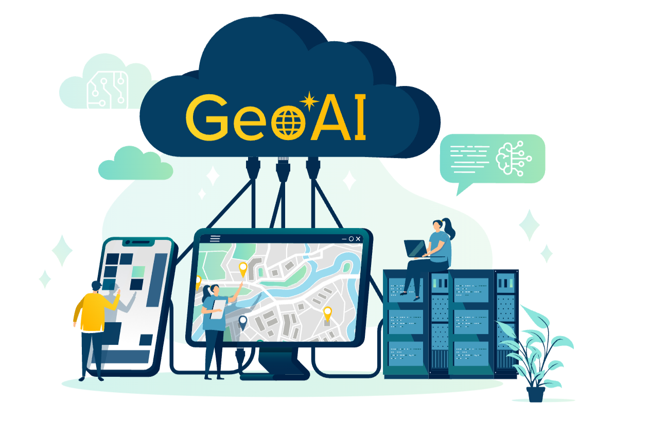
Illustration of GeoAI connecting maps, data and devices in the cloud
Why Silvacom CS

Geospatial expertise you can rely on

Picture5We're the software and technology arm of the Silvacom Group of Companies. We draw on decades of expertise in geospatial, environmental, forestry, ecological and remote sensing work, so our customers get deep domain knowledge and leading-edge digital innovation from one team. GeoAI is especially valuable for organizations that manage land, infrastructure, communities and natural resources.

  • Government trustedTrusted by governments across Canada.
  • 25+ yearsSupporting mission-critical geospatial systems.
  • Proven systemsUsed by utilities, land administrators and natural resource managers.
  • Enterprise scaleDeployed for thousands of users across enterprise environments.
GeoAI explained

What is GeoAI?

GeoAI (geospatial artificial intelligence) brings AI, including machine learning, deep learning, computer vision and natural language processing, together with geospatial data, science and technology. It connects GIS (geographic information systems), imagery, sensors, and advanced analytics to turn large, complex location data into automated, predictive, and real-time insights.

Automation

Automated feature extraction

Automate time-consuming tasks like identifying buildings, roads or land cover from imagery, classification, change detection and anomaly detection, so analysts can focus on decisions.

Prediction

Predictive modeling

Forecast outcomes such as wildfire spread or crop yield by analyzing spatial and temporal patterns.

Awareness

Situational awareness

Understand real-world conditions by combining imagery, point clouds, sensors and weather data in near real time.

Decisions

Data-driven decisions

Turn raw spatial data into clear, actionable insight through interactive maps, dashboards and confidence metrics.

Optimization

Spatial optimization

Improve routing and logistics, site selection and emergency response with spatial optimization and network analysis.

Quality

Data quality and governance

Improve accuracy, consistency and trust with AI-assisted QA/QC (quality assurance and quality control), automated validation rules and continuous monitoring.

The shift

How GeoAI transforms organizations

GeoAI is fast becoming a strategic capability for organizations that manage land, infrastructure, communities, assets and natural resources. It changes the way you work:

  • Manual workflows to automated data pipelines iconFrom manual workflows to automated data pipelines
  • Reactive decisions to predictive planning iconFrom reactive decisions to predictive planning
  • Maps and data to spatial intelligence iconFrom maps and data to spatial intelligence
  • Static reporting to real-time insight iconFrom static reporting to real-time insight

GeoAI shapes how we build modern geospatial systems. We believe it succeeds only with modernized systems, high-quality data, and deep domain expertise, and when AI enhances proven practices rather than replaces them. We use AI responsibly to improve data quality, automate processing, and deliver real-time insights, backed by the Silvacom Group's geospatial expertise.

The challenge

Why organizations need GeoAI

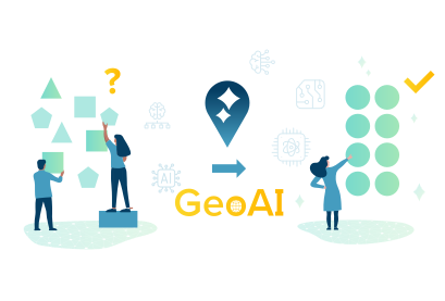
Organizations today face spatial challenges that legacy tools can't keep up with.
whygeoai

  • Manual data creation and QA/QC (quality assurance and quality control) is slow and unsustainable
  • Legacy GIS systems can't keep up with growing data volumes
  • Cadastral, parcel and land-use workflows are manual, slow and repetitive
  • Environmental reporting and compliance demand higher accuracy
  • Distributed teams need consistent information in near real time
  • Decision-makers need insight, not just data and maps

GeoAI delivers: automated, intelligent, end-to-end geospatial systems that speed up operations, increase accuracy, and unlock new levels of insight.

Capabilities

Our GeoAI capabilities

We help organizations move from static, legacy GIS to modern, AI-enhanced geospatial systems built for day-to-day operations. Every solution we deliver is secure, scalable and production ready.

Modernization

GIS modernization and web applications

We transform and integrate systems for better speed, scalability, performance, cloud readiness and user experience.

Automation

Data automation

We build automated pipelines, AI-driven processing and secure cloud infrastructure that remove manual effort and bring multi-source data together.

Development

Custom geospatial software

We develop tailored tools, enterprise applications and workflows for planning, analysis, permitting, reporting, field operations and regulatory or environmental management.

Strategy

Enterprise GeoAI enablement

We guide you from exploration to implementation with a GeoAI strategy, business case, architecture planning and deployment.

Value framework

The Silvacom CS GeoAI value framework

Measurable results across the enterprise.
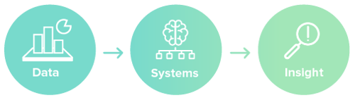
cs geoai - data systems insight

  • Efficiency:  Automate repetitive GIS workflows for faster updates with less effort and cost.
  • Accuracy and quality:  AI-powered validation and classification create more consistent, reliable datasets.
  • Speed and timeliness:  Speed up processing, approvals, workflows and data access, and shorten the time from capture to action.
  • Insight and foresight: Enable real-time intelligence, predictive analysis and proactive planning.
  • Scalability and interoperability:  Systems designed for growth.
  • Trust, security and governance: Explainable models, auditability, privacy and compliance.
Our advantages

Why we're positioned to guide responsible GeoAI modernization

We bring together geospatial science and technology, domain expertise, software engineering, AI innovation and operational excellence.

  • A proven legacyFrom provincial GIS systems to enterprise modernization projects, we've supported public and private organizations for more than 25 years.
  • Deep technology expertiseEnterprise-grade cloud architecture, DevOps, software engineering and system design.
  • Esri Gold PartnerParcel Fabric specialization and extensive experience deploying, modernizing and integrating Esri technologies.
  • We augment, not replaceWe get more from your existing investments and modernize without disruption.
  • Early adopters of MCPWe use MCP (Model Context Protocol) to connect AI and GeoAI directly to your existing enterprise tools, unlocking new levels of automation and insight.
  • Trusted across sectorsGovernments, utilities, energy companies, forestry organizations and environmental agencies rely on our solutions to run mission-critical operations.
Silvacom Group

The power of the Silvacom Group

We draw on domain expertise from across the Silvacom Group of Companies. Our shared knowledge of land, the environment, communities and regulatory systems is what makes GeoAI practical and effective.

  • Silvacom Ltd. Forestry, natural resources, environment, remote sensing and wildfire.
  • MNC Cadastral and parcel mapping and digital plan checking.
  • Osprey Environmental Solutions Environmental services and Indigenous knowledge integration.

  • Altalis Alberta's authoritative spatial data, mapping and distribution.
  • Jambo Stakeholder relationship management (SRM) software.
  • Silvacom FMS Leading forest management software.
Why Silvacom CS

Why customers choose Silvacom CSScreenshot 2025-12-05 at 4.15.00 PM

  • We modernize geospatial systems end-to-end
  • We reduce manual work at every stage
  • We use AI where it delivers real value, not as hype
  • We build practical, usable, production-grade systems
  • We bring cross-industry expertise from across the Silvacom Group
  • We deliver measurable results

We don't just build GeoAI systems, we help organizations put them to work. We take a responsible, transparent approach so every implementation is safe and aligned with your governance. We prioritize stability, oversight and incremental adoption, so AI improves operations without adding risk.

Built for the modern enterprise

Shaping the future of geospatial technology

We help teams move beyond static maps and manual workflows toward intelligent, connected systems that learn, adapt and deliver continuous improvement.landscape
  • Open standards and interoperability
  • Cloud-first architectures
  • AI-ready data models
  • Model Context Protocol (MCP) compatible interfaces for enterprise AI agents
How it works

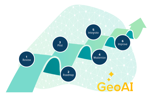
Our GeoAI adoption journey

A clear, low-risk path from exploring GeoAI to using it every day.
Screenshot 2025-12-05 at 4.16.05 PM

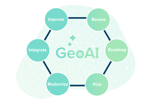
  1. Assessment and readiness review. We evaluate your data, infrastructure, skills and governance, and define success metrics, risks and return on investment.
  2. Strategy and roadmap. We select high-value, feasible AI and automation use cases and sequence the investment with milestones.
  3. Pilot project. We deliver one or two use cases end-to-end to prove performance, fit and business value with measurable outcomes.
  4. Platform modernization. We upgrade GIS, migrate data, set up data models and pipelines, and deploy secure cloud infrastructure and integrations.
  5. GeoAI integration. We embed AI models and automations, connecting them to your business processes and workflows.
  6. Scale and govern. We expand GeoAI across departments with secure, managed operations.

We move GeoAI from theory to safe, practical, everyday operations. GeoAI only delivers real value when it's built on modernized systems, high-quality data and deep geospatial and environmental expertise.

Get started

Ready to modernize with GeoAI?

Most organizations start with a low-risk, 30-day assessment. It quickly identifies high-value GeoAI opportunities, evaluates data and system readiness, highlights modernization gaps and uncovers potential for predictive modeling and automation.

FAQs

Frequently asked questions about GeoAI

How is GeoAI different from traditional GIS?

GeoAI is the evolution of geospatial technology. It integrates artificial intelligence, including machine learning, deep learning, computer vision and natural language processing, with geospatial data, science and technology, turning vast and complex location-based information into automated, predictive and real-time insights. It can automate time-consuming tasks like feature extraction, classification, change detection and anomaly detection, so analysts can focus on higher-level decision making.

What does a GeoAI readiness assessment include?

Most organizations begin with a low-risk, 30-day assessment that quickly identifies high-value GeoAI opportunities, evaluates data and system readiness, highlights modernization gaps and uncovers potential for predictive modeling and automation.

Do we need to replace our existing GIS to use GeoAI?

No. We augment, not replace, existing systems. We maximize your existing investments and modernize without disruption.

How do you make sure GeoAI is used responsibly?

We take a responsible, transparent approach to GeoAI, ensuring every implementation is safe and aligned with organizational governance. We prioritize stability, oversight and incremental adoption so that AI enhances operations without introducing risk, and our value framework includes explainable models, auditability, privacy and compliance.

What is MCP and why does it matter for GeoAI?

MCP (Model Context Protocol) lets AI and GeoAI connect directly with existing enterprise tools. We were early adopters of MCP and use it to unlock new levels of automation and insight, and we build MCP-compatible interfaces for enterprise AI agents.

How does the Silvacom Group support GeoAI projects?

Silvacom CS is part of the Silvacom Group, so we can bring specialist expertise into GeoAI projects from across the group: Silvacom Ltd. (forestry, natural resources, environment, remote sensing and wildfire), MNC (cadastral and parcel mapping and digital plan checking), Osprey Environmental Solutions (environmental services and Indigenous knowledge integration), Altalis (Alberta's authoritative spatial data), Jambo (stakeholder relationship management software) and Silvacom FMS (cloud-based forest management software).

We've been building cloud-based solutions since 2001

We're the integrated end-to-end solution partner you've been looking for.

Let's talk about your project