Our approach

Geospatial solutions that start with your vision

We work with organizations to turn their vision into highly functional, geospatial-enabled web applications. We deliver working prototypes early and add value with every iteration.

Illustration of a cloud-based geospatial platform connecting maps, data and devices
How we work

Our core iterative process

We create value continuously by delivering prototype software early and building on it with each iteration. We tailor every step to you and your project's needs.

Step 1

Define

We make sure everyone shares a clear understanding of the vision through collaboration and evidence. We use visualizations backed by technical requirements to show you a clear picture of how we'll get there.

Step 2

Visualize

We use sequencing and prototyping to map key moments in your users' journey. Prototypes save time and money by allowing us to quickly create, test, and revise a solution before investing in full development.

Step 3

Develop

We apply the best technology for the job, with quality and security built into how we work. We secure, test and release each iteration, building on the last and validating it for operational stability and value.

Technologies

Technologies and capabilities

We choose the technologies and methods that work best for each project, depending on its scale.

Software development life cycle


  • Agile (Scrum and Kanban) logoAgile (Scrum and Kanban)
  • DevOps logoDevOps
  • Lean logoLean
  • Service design logoService design
  • Waterfall logoWaterfall
  • Business analysis logoBusiness analysis

Geospatial platforms


  • Esri logoEsri
  • ArcGIS Online logoArcGIS Online
  • FME logoFME
  • GeoServer logoGeoServer
  • GeoTools logoGeoTools
  • OpenLayers logoOpenLayers
  • Leaflet logoLeaflet
  • NoSQL (MongoDB) logoNoSQL (MongoDB)

Modern web applications


  • Angular logoAngular
  • React logoReact
  • HTML logoHTML
  • CSS logoCSS
  • Node.js logoNode.js
  • Java logoJava
  • Python logoPython
  • Serverless logoServerless
  • PostgreSQL logoPostgreSQL
  • Oracle logoOracle
  • Enterprise geodatabases logoEnterprise geodatabases
  • MinIO logoMinIO

Deployment


  • Amazon Web Services (AWS) logoAmazon Web Services (AWS)
  • Docker logoDocker
  • Kubernetes logoKubernetes
  • Microservices logoMicroservices
  • Spring Boot logoSpring Boot
  • Microsoft Azure logoMicrosoft Azure
Testimonials

What our customers say

Silvacom CS brought exceptional technical insight

At the LTSA, we rely on Silvacom as a trusted strategic partner for our GeoSpatial solutions. Most recently, we partnered on an innovative R&D initiative to automate the integration of Posting Plans into our Parcel Fabric. Silvacom brought exceptional technical insight and a strong grasp of our business needs, paired with deep expertise in ESRI products, FME, and Parcel Fabrics. Their leadership and collaboration delivered a seamless and successful Proof of Concept. The outcome was clear roadmap to impactful automation that will drive significant time savings and operational efficiencies in a mission-critical workflow.

Taylor McInnes Manager, GeoData Services, Landsure

Silvacom CS saved my sanity

We are a small municipality who were trying to get the basics of our new GIS system functioning and automated. The Silvacom CS team took the time to figure out where we were at in our journey and provide solutions that just worked. They have been available to answer questions and help with things since finishing the work. They were flexible and worked with us to fit our budget and timeline. I would not have been able to get our GIS system to the level it is now without them.

GIS Coordinator, Town of Stony Plain

Silvacom CS brings great leadership and experience

We were fortunate to have Silvacom CS as our partner for over a decade on a very complex engagement. Throughout the journey, Silvacom CS’ leadership around geospatial data and experience with visioning and creating a visually appealing user experience were key pieces to our joint success. Their responsiveness, flexibility and commitment to a successful outcome make Silvacom CS a great partner.

Craig Coward Client Executive, NTT Data Services

Choosing Silvacom CS proved to be the right decision for us

Silvacom’s process of design and implementation kept multiple stakeholders from several different organizations/jurisdictions well informed through the design and development of a much-needed critical infrastructure digital project that impacts us all as Albertans.

Todd Nash Partner, Consulting Services, MNP

I highly recommend the Silvacom team

They worked very hard to understand our vision and turn it into something that is tangible, user-friendly, and visually appealing.

Brock Mulligan Director of Communications, Alberta Forest Products Association

Silvacom has been great to work with

We were looking to develop a technical solution for tracking, displaying and storing its forest history photographs, stories and information. My team is not well versed in technology options; thankfully the Silvacom CS team has made the process easy while engaging our members in the analysis and review. I highly recommend Silvacom CS considering the experience their team brings to a project or initiative.

Bruce Mayer Secretary-Treasurer, Forest History Association of Alberta

Silvacom CS helped us create the website we needed to elevate our program

With a short turnaround time, we were glad to have the Silvacom CS team on our side! Their team worked diligently to not only ensure that our new website was completed within a tight deadline but that we were involved in every step of the design process. With their expertise, we felt comfortable that our vision for a website that would highlight and bolster our program would be executed to the best of their abilities. Silvacom CS is a great partner, and we would recommend their services to other organizations.

Project Coordinator, FAST Program
Our work

Our work

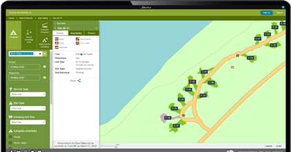
Our work: Reserve Alberta Parks campsite reservation system
Reservations

Reserve Alberta Parks

ReserveAlbertaParks.ca is an Alberta campsite registration and reservation system that helps friends and families get away and spend time together outdoors.
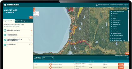
Our work: The FireSmart Hub wildfire planning system
Wildfire planning

The FireSmart Hub

A map-centric system that helps communities plan, create, manage and share FireSmart plans so they're better protected from the risk of wildfire.
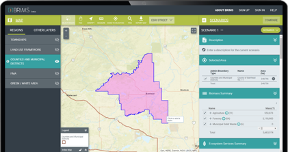
Our work: BRIMS, the Bio-Resource Information Management System
Bio-resources data

Bio-Resource Information Management System (BRIMS)

A central home for Alberta's bio-resources data. Its interactive web tool lets users map, summarize and report on biomass and other ecosystem services data.
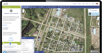
Our work: The Altalis Datastore spatial data store
Spatial data

The Altalis Datastore

Altalis is Western Canada's trusted source of spatial data. The Altalis.com datastore enables customers to explore, view and acquire spatial data products, both paid and open data, with the click of a button.

FAQ

Frequently asked questions

What is Silvacom CS's development process?

We use a core iterative process with three stages: define, visualize and develop. Our team continuously creates value by delivering prototype software early on and increasing its value through each iteration, and we tailor our approach to you and your project's needs.

Do you use Agile or waterfall?

Both. We choose the methodology that best fits each project's scale and needs, including Agile (Scrum and Kanban), DevOps, Lean, service design and waterfall, supported by business analysis.

How do you keep stakeholders involved?

We make sure everyone has a solid understanding of the vision through collaboration and evidencing, and we communicate through visualizations that are supported by technical requirements.

Why do you prototype before full development?

Prototyping saves time and money because the solution can be quickly created, evaluated and revised without spending long periods developing it.

How do you handle quality and security?

Quality and security are principles embedded in our development practices. Our team collaborates to develop and test each iteration, and we believe in continuous releases that build on the previous version, validating each iteration to ensure operational stability and value.

Which technologies do you work with?

We choose the technologies and methodologies that work best for each project, depending on its scale. They include Esri, ArcGIS Online, FME, GeoServer, GeoTools, OpenLayers and Leaflet, web technologies such as Angular, React, Node.js, Java and Python, and deployment on Amazon Web Services (AWS), Docker, Kubernetes and Microsoft Azure.

We've been building cloud-based solutions since 2001

We're the integrated end-to-end solution partner you've been looking for.

Let's talk about your project