Our work

Geospatial solutions for every industry

We've worked with a wide range of industries, organizations and governments. We can build a complete end-to-end solution or extend your development team with geospatial expertise, tailoring our approach to you and your project's needs.

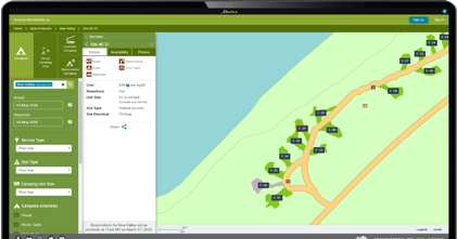
Illustration of a cloud-based geospatial platform connecting maps, data and devices
Featured projects

Platforms we've built

Contact us about Reserve Alberta Parks
Campsite reservations

Reserve Alberta Parks

Built by Silvacom CS and Sierra Systems for the Government of Alberta, ReserveAlbertaParks.ca is the province's campsite registration and reservation system.

Highlights: map-based interface, online reservation manager and enhanced search.
Visit the FireSmart Hub website
Wildfire planning

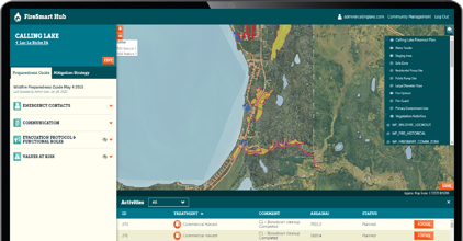
The FireSmart Hub

A map-centric system that helps communities plan, create, manage and share FireSmart plans so they're better protected from the risk of wildfire.

Highlights: map drawing tools, GIS data import and export, step-by-step plan creation and milestone tracking.
Visit website

Contact us about BRIMS, the Bio-Resource Information Management System
Bio-resources data

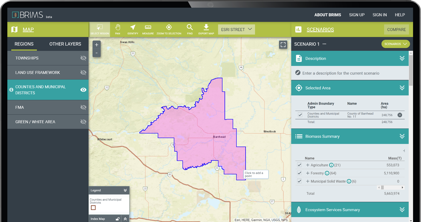
Bio-Resource Information Management System (BRIMS)

Designed for Alberta Innovates as a central home for the province's bio-resources data, helping connect investors to Alberta's biomass, ecosystem services and land-use data.

Highlights: locate biomass and ecosystem services, filter and search data, build and compare scenarios and save supply reports.
Visit the Altalis website
Spatial data

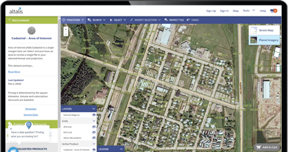
The Altalis Datastore

Altalis is Western Canada's trusted source of spatial data. The Altalis.com datastore enables customers to explore, view and acquire spatial data products, both paid and open data, with the click of a button.

Highlights: integrated map interface, online payments, custom formats and projections, data subscriptions and instant updates through the Altalis API.
 

Visit website

Visit the Silvacom FMS website
Forest management

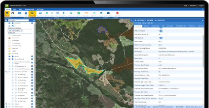
Silvacom FMS

Built by Silvacom CS, Silvacom FMS (Forest Management System) is a leading cloud-based forest management software as a service (SaaS).

Highlights: Esri-based application, in-app spatial editing, third-party integrations, strong data security and regular updates.
Visit website

Visit the Forestry History Media Catalogue website
Forest history

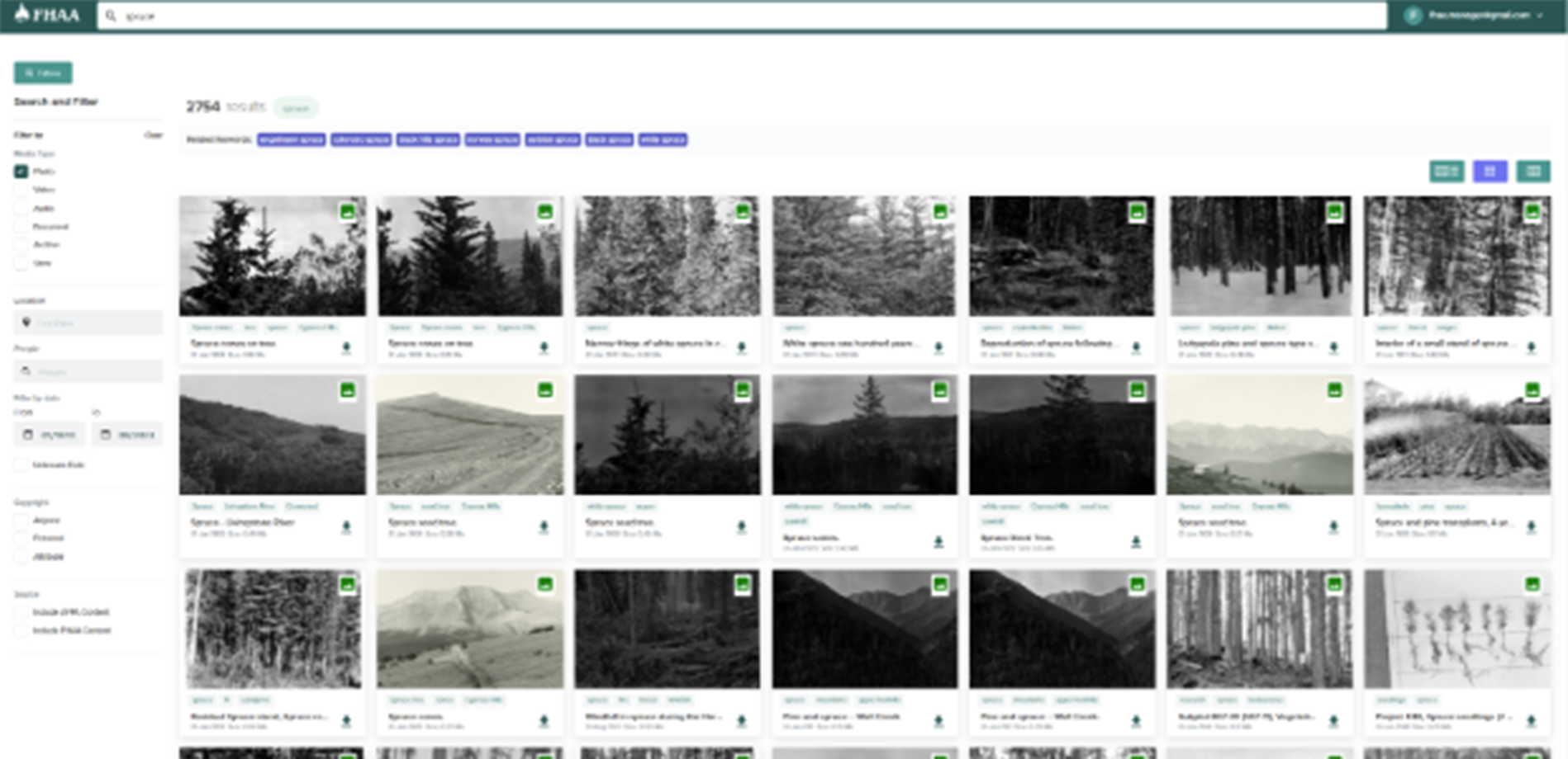
Forestry History Media Catalogue

A cloud-based catalogue that gives the public, the forest industry and other stakeholders the tools to search, upload and explore media about Alberta's forestry history.

Highlights: tag-based and filtered search, single and batch uploads, user and content management, dashboards and reporting.
Visit website

Land administration

Digital tools for land titles and surveys

Contact us about Plan Submissions Online (PSO)
Land titles

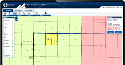
Plan Submissions Online (PSO)

A web-based plan submission and checking tool that automatically verifies all mandatory information is provided before plans go to ISC (Information Services Corporation) Plan Processing in Saskatchewan.

Highlights: commercial off-the-shelf plus (COTS+) solution, document validation and visual checks against the cadastral mapping base.
Visit the Survey Plan Online Checker (SPOC) website
Survey plans

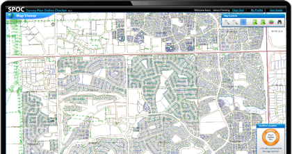
Survey Plan Online Checker (SPOC)

Lets Alberta land surveyors check that their survey plans meet Alberta Land Titles specifications before they submit them to the Land Titles Office (LTO).

Highlights: custom geospatial web application, digital plan validation, and the ability to fix issues and revalidate before submission.

Visit website

Recognition

Awards and certifications

Awards

  • Adobe MAX Awards 2009 semi-finalistAdobe MAX Awards
  • Esri award logoEsri award
  • GTEC award logoGTEC award
  • Hermes Creative Awards logoHermes Creative Awards
  • Premier's Award of Excellence logoPremier's Award of Excellence

Team certifications

  • ArcGIS Desktop Certified Professional badgeArcGIS Desktop Professional
  • FME Certified Professional logoFME Certified Professional
  • AWS Certified Solutions Architect Associate badgeAWS Certified Solutions Architect
  • Certified Kubernetes Application Developer logoCertified Kubernetes Application Developer

  • Microsoft Certified Fundamentals logoMicrosoft Certified Fundamentals
  • IIBA CCBA logoIIBA CCBA
  • CGD Certified logo Certified Graphic Designer


Testimonials

What our customers say

Silvacom CS brought exceptional technical insight

At the LTSA, we rely on Silvacom as a trusted strategic partner for our GeoSpatial solutions. Most recently, we partnered on an innovative R&D initiative to automate the integration of Posting Plans into our Parcel Fabric. Silvacom brought exceptional technical insight and a strong grasp of our business needs, paired with deep expertise in ESRI products, FME, and Parcel Fabrics. Their leadership and collaboration delivered a seamless and successful Proof of Concept. The outcome was clear roadmap to impactful automation that will drive significant time savings and operational efficiencies in a mission-critical workflow.

Taylor McInnes Manager, GeoData Services, Landsure

Silvacom CS saved my sanity

We are a small municipality who were trying to get the basics of our new GIS system functioning and automated. The Silvacom CS team took the time to figure out where we were at in our journey and provide solutions that just worked. They have been available to answer questions and help with things since finishing the work. They were flexible and worked with us to fit our budget and timeline. I would not have been able to get our GIS system to the level it is now without them.

GIS Coordinator, Town of Stony Plain

Silvacom CS brings great leadership and experience

We were fortunate to have Silvacom CS as our partner for over a decade on a very complex engagement. Throughout the journey, Silvacom CS’ leadership around geospatial data and experience with visioning and creating a visually appealing user experience were key pieces to our joint success. Their responsiveness, flexibility and commitment to a successful outcome make Silvacom CS a great partner.

Craig Coward Client Executive, NTT Data Services

Choosing Silvacom CS proved to be the right decision for us

Silvacom’s process of design and implementation kept multiple stakeholders from several different organizations/jurisdictions well informed through the design and development of a much-needed critical infrastructure digital project that impacts us all as Albertans.

Todd Nash Partner, Consulting Services, MNP

I highly recommend the Silvacom team

They worked very hard to understand our vision and turn it into something that is tangible, user-friendly, and visually appealing.

Brock Mulligan Director of Communications, Alberta Forest Products Association

Silvacom has been great to work with

We were looking to develop a technical solution for tracking, displaying and storing its forest history photographs, stories and information. My team is not well versed in technology options; thankfully the Silvacom CS team has made the process easy while engaging our members in the analysis and review. I highly recommend Silvacom CS considering the experience their team brings to a project or initiative.

Bruce Mayer Secretary-Treasurer, Forest History Association of Alberta

Silvacom CS helped us create the website we needed to elevate our program

With a short turnaround time, we were glad to have the Silvacom CS team on our side! Their team worked diligently to not only ensure that our new website was completed within a tight deadline but that we were involved in every step of the design process. With their expertise, we felt comfortable that our vision for a website that would highlight and bolster our program would be executed to the best of their abilities. Silvacom CS is a great partner, and we would recommend their services to other organizations.

Project Coordinator, FAST Program
FAQs

Frequently asked questions about our work

What kinds of projects does Silvacom CS deliver?

We build geospatial web applications, data platforms and digital plan submission tools. Examples include Reserve Alberta Parks, the FireSmart Hub, BRIMS, the Altalis Datastore, Silvacom FMS, the Forestry History Media Catalogue, PSO and SPOC.

Do you work with government?

Yes. We have a wide range of experience working with many industries, organizations and governments. Our projects include Reserve Alberta Parks, built with Sierra Systems for the Government of Alberta, BRIMS for Alberta Innovates, PSO for Saskatchewan's ISC (Information Services Corporation) and SPOC for Alberta's Land Titles Office.

Can you take on part of a project rather than all of it?

Yes. We can deliver a complete end-to-end solution, or extend your existing development team with geospatial expertise where you need it.

Do you support applications after launch?

Yes. Ongoing sustainment and operations are part of our partnership process, and we believe in continuous releases that build on the previous version. NTT Data Services, for example, partnered with us for over a decade on a very complex engagement.

Which industries do you work with?

We have a wide range of experience working with many industries, organizations and governments. Governments, utilities, energy companies, forestry organizations and environmental agencies rely on our solutions, and we draw on expertise from across the Silvacom Group.

How do we start a project with you?

Tell us about your project through our contact page. We tailor our approach to you and your project's needs.

We've been building cloud-based solutions since 2001

We're the integrated end-to-end solution partner you've been looking for.

Let's talk about your project